Poggio Pratone

Itinerary 1

"In the heart of Tuscany" Poggio al Sole - Poggio Pratone - Montereggi - Poggio al Sole

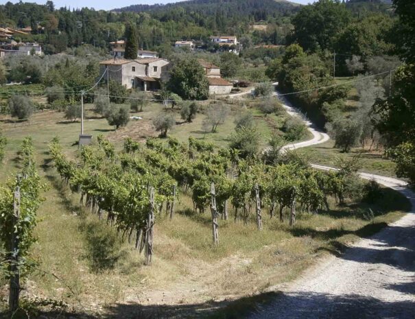
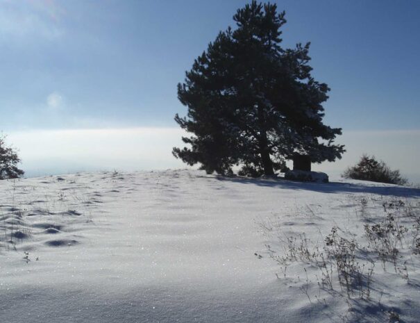
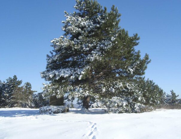
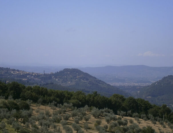
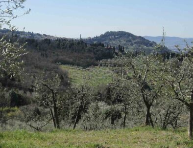
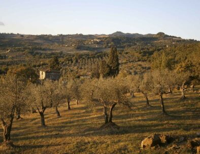
Loop itinerary in the territory of Fiesole, in the very heart of Tuscany. The trail is intense, but rather short and not too strenuous, and it allows enjoying a panoramic view of the peculiar Fiesole countryside. The majority of the itinerary runs through trails, untarred roads and rural territories, still you will feel the magic vicinity of the city of Florence, the ancient and silent harmony of its past and present people.

Distance: 8 km – 4,96 miles (Poggio al Sole – Poggio Pratone 4 km – 2,48 miles)
Elevation gain: 350 m
Difficulty: average-easy
Estimated time: 2,30-3,00 hours
Suggested time of the year: all year round (during rainy periods there may be muddy segments)
Interest: landscape trail

Leave the entrance of the farmhouse Poggio al Sole on your right and proceed for about 500 m along via Torre di Buiano, an ancient place-name presumably of Longobard origin, already referred to as corticella di Bujana in some documents dating from 890. Ignore the two streets crossing it – one on your left descending and the other climbing on the right- and drive along the hay barn with annexed farm house, Podere l’Acquinvoglino, until you cross Via dell’Acquinvoglino, then turn right in opposite direction to the houses. It is said that the name of this ancient road comes from the Latin word acqua bulliens (gurgling water)due to the presence of numerous springs (the majority of which are now dried up)known since the Roman age and used to supply the aqueduct of Fiesole and the XVI century-aqueduct of Florence, which can be still seen at the bottom of the valley.
Once you get to Via dei Bosconi (S.P.54), turn left and then take via Catena, which is immediately on the opposite site, toward Monteloro. After 500 m you will get to Passo della Catena (515 m.). Take trail n. 2 on the right, which is marked with a white and red stripe, toward Poggio Pratone. This 3 km (1,86 miles) trail winding through the ridge of Montereggi is well signaled and of easy access, although a bit steep in some parts. The name comes from the Latin word Mons Regis, “The King’s mountain”: tradition has it that Radagasio, the king of the Ostrogoths, was buried or at least captured here, after being defeated in year 406 by the Roman troops led by the German general Flavio Stilicone, during the last great battle fought by the Roman Empire before its definitive fall.
The trail passes through pinewoods and oaks, brooms and junipers, where it is likely to see roe deers, pheasants and quails. With a little bit of luck you may also see wild porks and foxes, or spot some kestrels flying around. The trail offers continuous viewpoints with amazing sight over the high valley, Mugnone and the Fiesole hills. Among these, Montececeri is particularly famous for the extraction of Pietra Serena, a valuable lapideous material used by the finest Renaissance sculptors and architects the likes of Brunelleschi and Vasari. Montececeri is also known as the Mountain of Swans (hence its name), where, according to legend, Leonardo da Vinci took inspiration for his experiments on the flight of human beings. Monte Senario, with its secular monastery, Monte Morello and the valley of Florence all watch from a distance. On the opposite site stands San Clemente valley, which plays host to several ancient summer residencies, such as those of poet Dante Alighieri’s family and Beatrice Portinari, the protagonist of “the Divine Comedy” and his guide through the Heaven. Further on you can also see Monteloro, the Monastery of the Madonna del Sasso, Saint Brigida and Mount Giovi.
Finally you reach the top of the municipality of Fiesole, Poggio Pratone (702 mt): a graveyard was built here to commemorate the local writer Bruno Cicognani. The view opens on a wide landscape, so vast that the human eye can hardly capture it all. In the clearest days, it is said that even the sea can be seen from here, probably an overstatement, which shows, nonetheless, the charm of this place. Beyond Fiesole and Florence, the eye can embrace a large part of Tuscany. From east to the west: the region of Casentino and Pratomagno, the Chianti hills, and sometimes the distant Mount Amiata, the Metal Hills and Apuan Alps. Now go back to the road you just came from, and face north toward the natural amphitheatre of the Mugnone Valley, the pre-Apennines and the ridge separating the area of Mugello from suburban Florence, a mountain pass which recalls the famous Roman battle where hundreds of soldiers lost their lives.
Now pass by the graveyard, ignoring the main track (CAI n. 2) and turning immediately on the right into trail n. 9 going to Querciola. Keep the right while descending; after 5 minutes the road flattens out and you will cross a channel which leads to a large meadow. Take the pebble road on the left which winds through European hornbeams and oaks. The final segment of the trail intersects with Via Poggio Montereggi, a country road which leads to the Burraia spring (absolutely worthy of visit), surrounded by cypresses. Water springs out from an ancient, stone-made structure made up of basins, where, until not so long ago, the processing of butter took place.
Back to the end of the trail, the footpath keeps descending until it intersects again with Via dei Bosconi. Leave trail n. 9 and take Via Montereggi which descends on the right (while on your left you have the rural house of S. Quirico). In proximity stands the little parish of Sant’Ilario a Montereggi, dating back to the IX century. The road soon becomes untarred but always of easy access. This area was the most suitable for cultivations, in fact you will plunge into a landscape of vineyards, olive groves, fruit trees, oak woods and rural houses, a splendid countryside where nothing is casual, but the result of the secular metayage tradition, a system based on sharecropping between a landowner and a tenant. This tradition was largely used until the second half of the past century.
Watch attentively the vineyards: some are intertwined with other trees, usually maples or populus. This is not a sign of degrade or abandon, on the contrary: these trees are real wrecks, a sort of art work, both natural and artificial, which was once mastered by the farmers, who found the way to turn the harshness of rural life into a prosperous activity.
Be careful when you walk this road, since there are no signs: by the first crossroads, in proximity of the vineyards of the Farmhouse Montereggi of Borsini family (who once owned 11 lands in this area), ignore the climbing road and turn left, then, by a second crossroads in proximity of a cypress tree, turn right, leaving the main road and driving along a fence on the left. Cross the channel Fosso di Buiano; then take again the direction on the left. Two splendid rural structures will come in sight, both of which display the typical dovecot in the middle of the roof. By the following crossroads turn right passing by the farm house Palagio, then walking through olive groves and vineyards, the barn hay and the farmhouse La Villa.

Here, in proximity of a tank, the gurgling of water can be heard after abundant rainfalls. Right in front of you stands the village Olmo, with the medieval Tower of Villa Ginnasi watching over the ancient road; the Faentina, which connected Florence to Mugello and to the north of Italy; and Villa Capacci, a majestic example of farmhouse belonging to hospital institutions.
At this point, in proximity of a juglans and a huge oak tree, the footpath starts climbing on the right, and after passing another dilapidated rural complex, the Palagina, it intersects with via Torre du Buiano, then on the right and back to the Agriturismo Poggio al sole, from where it started.


Itinerary and photos by Giovanni Crescioli: www.FiesoleBike.it